Midwest Engineering Associates, Inc.’s goal is to provide value and service to our clients, and to meet the needs of each individual project. Our Professional Land Surveyor and technicians use the latest GPS and robotic equipment to collect project data in a format that can be easily adapted to specific project needs. The collection of accurate project data is of extreme importance for survey projects, and creates the foundation for successful design projects in other disciplines where the survey data will be used as part of the design process.
Our Surveying staff has extensive experience with surveying on many different types of projects for both public and private sector clients. Examples of types of projects include:
Boundary Surveys, from the small residential subdivision lot to large tracts of land. Our staff of land surveying professionals have the equipment and experience to complete even the most complex boundary surveys.
Land Surveying, route surveying and preparation of plats and legal descriptions used in land acquisition for right of ways and easements for utilities and roadways. Our firm also has the capability of setting, measuring and adjusting both horizontal and vertical control for any size project.
Construction Layout and Staking Services, including the locating of horizontal and vertical points used in order to construct a variety of projects, including work on building projects, land development site, industrial machinery, and on transportation projects for roadways, highways, bridges and culvert structures.
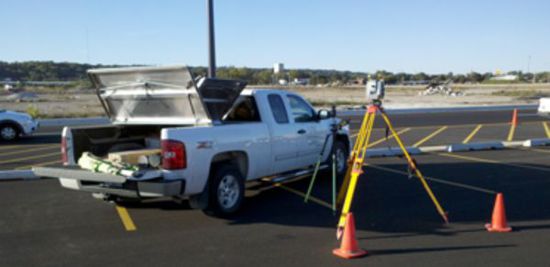
3D Laser Scanning Services, using 3D Laser scanning technology, we can capture 970,000 precision measurements per second, measure complex geometrics and overhead structures without manlifts, improve accuracy and reduce labor costs, and create 3D models and CAD files.